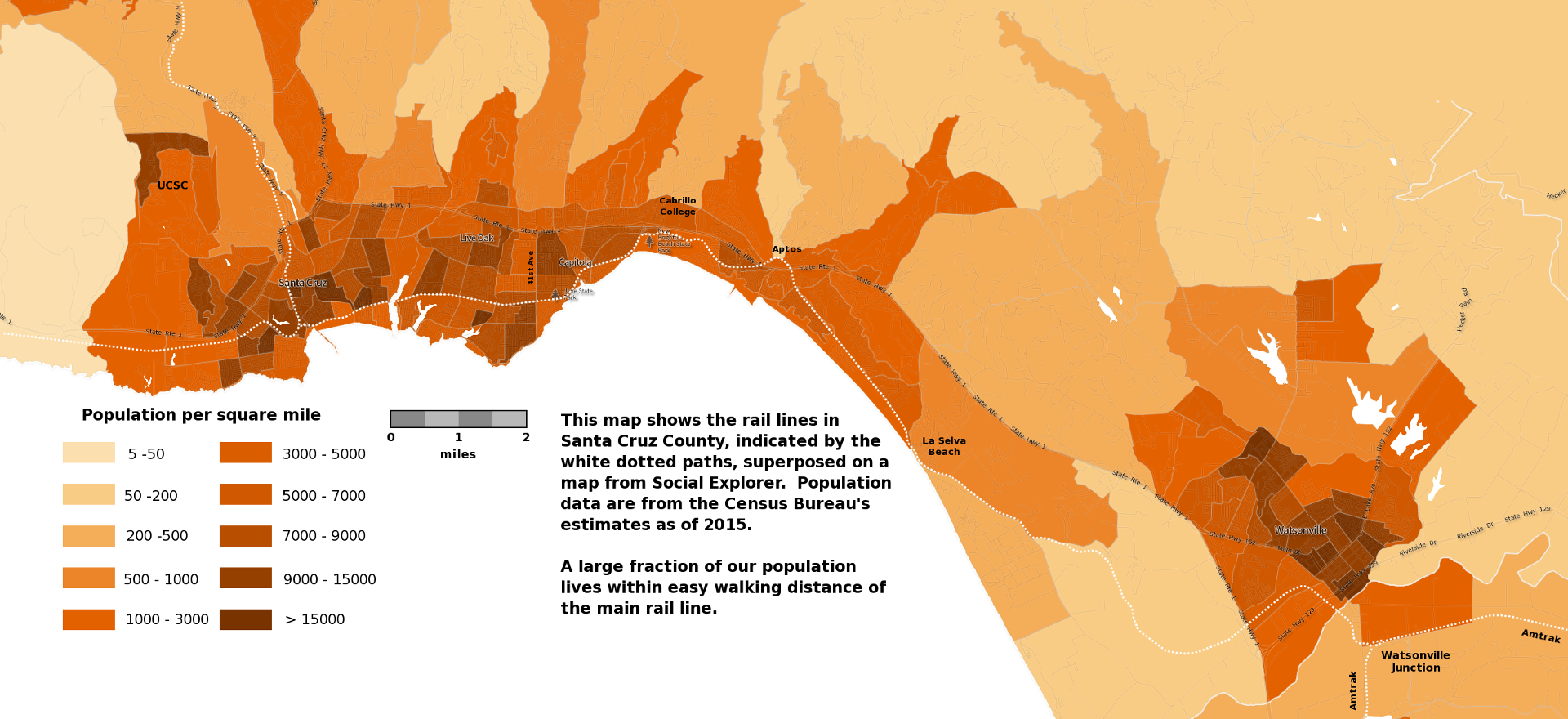
Notes about the map above
Click on the map to toggle its image in full screen. A pdf of the map is available here. The map was made starting from Social Explorer to get the image of Santa Cruz County with its population densities. We then added the precise routes of rail lines in the county to the image, along with a legend and additional text.
Many of the areas in the County have surprisingly large population densities. The most densely populated census block group on the map is the small triangle in Live Oak just south of the rail line, with 32,508 persons per square mile, and many other areas have population densities in excess of 15,000 persons per square mile.
Here's the question: Is our population density great enough to support passenger rail service along the Santa Cruz Branch Line?
Although successful passenger rail service depends on several factors, experience from similar operating rail lines shows that feasible rail service requires a population density greater than 4,000 to 5,000 per square mile in the vicinity of the rail line. This is easily satisfied here, as can be seen from this map.
Our population densities are similar to those in the San Jose area, or in the area of the southern San Francisco peninsula, where passenger rail service has proven to be successful.
On the map we see that the Capitola Mall is less than half a mile—about a 10-minute walk—from the intersection of 41st Avenue with the rail line. Cabrillo College is even closer, although separated from it by the Highway 1 freeway.
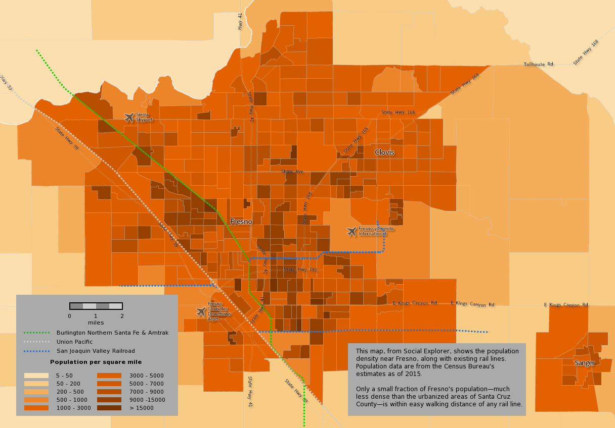
Compare Santa Cruz with Fresno:
Fresno's population of 972,000 is almost four times that of Santa Cruz County's, but it's not nearly as densely populated. Click on the map to toggle its image in full screen.
Fresno is not as well-suited as Santa Cruz County for providing passenger rail transportation, since only a small percentage of its population lives near any of its rail lines.

Threats to the Rail Corridor…and a Slide Show
There is a group of folks who do not like the idea of public transportation within the rail corridor, and is strongly urging our Regional Transportation Commission to throw away millions of dollars and rip up the tracks.
So we decided to make a slide show available. It's a show that was put together by Bruce Sawhill, who is a person who is knowledgeable and up to date about how we could make use of our rail corridor for public transportation. So if you're interested in an expert's analysis and vision for the future of our rail corridor, click on this link and watch the show.
