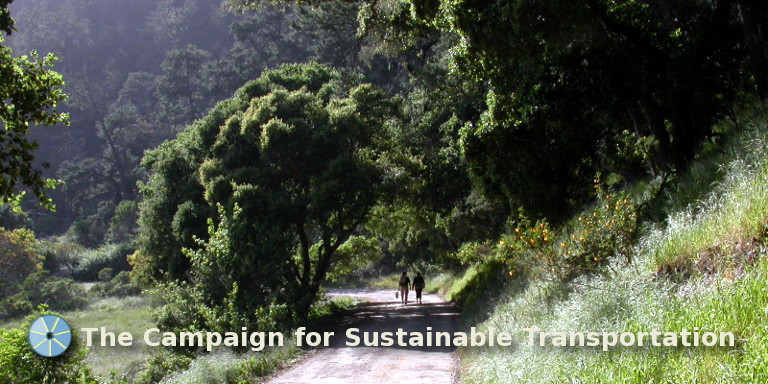
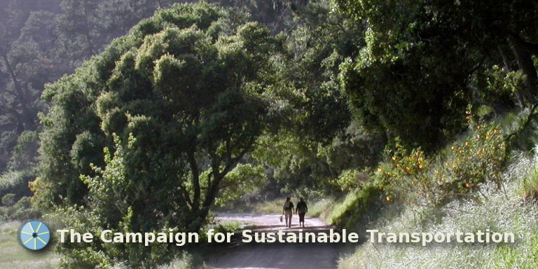
Big Basin: Leave your car at home!
With brain fatigue, you are easily distracted, forgetful and mentally flighty…but an innovative new study from Scotland suggests that you can ease brain fatigue simply by strolling through a leafy park.
Summer weekend bus service from downtown Santa Cruz to Big Basin Redwoods State Park provides many opportunities for hiking, camping and “strolling through a leafy park” without having to use a car.
ALERT:
Unfortunately, effective on September 8, 2016, METRO
eliminated the weekend Big Basin bus service, along with
the service to Waddell Beach. If
you would like to see this service restored,
consider writing to Mike
Rotkin (METRO Board Chair) and/or Supervisor Bruce McPherson (METRO Board
member and Supervisor for the Fifth District) and/or Alex
Clifford (CEO of METRO) to urge them to restore this
service as soon as possible. Big Basin State Park is
visited by over half a million people each year,
all of whom
arrive in a private automobile. We need public
transportation access to such places, especially those as
popular as Big Basin.
Furthermore: the
marvelous popular hike described below—from the Park
Headquarters down to Waddell Beach—requires the
existence of the bus service. To attempt it by using cars
involves an almost impossible and time-consuming car shuttle.
The hikes start with a relaxing bus ride
The hikes described on this page start at the Metro Center on Pacific Avenue in Santa Cruz, where the No. 35A bus leaves for Big Basin at 8:30 a.m., to arrive at the Big Basin Park Headquarters at 9:45 a.m. The large windows in the bus, with seats higher than those in any car, afford excellent views along the way.
The trip makes a fine geological transect of northern Santa Cruz County, from the San Lorenzo River flood plain (yes, that's Pacific Avenue), up through the ancient sand parklands along Mount Hermon Road, then along the Ben Lomond Fault zone through which the San Lorenzo River flows, before arriving in the redwood forest of the park. It is also a sociological transect, perhaps related to the geology: The folks in Santa Cruz are different from those in Scotts Valley, who in turn are different from those in the San Lorenzo Valley, who in turn are different from those in the vicinity of Big Basin.
Notes about our geology: If you would like to learn about the remarkable geology of our county, we have prepared some notes. These notes are based on comments by UCSC Professor Bob Garrison, who knows about our geology. If you download this pdf and print it, you can take it with you on the bus, to get acquainted with the formations as you ride by them. There are several clickable links in the pdf document, well worth extensive study.
Big Basin Redwoods State Park has over 80 miles of trails, and seven trail camps for use by backpackers, so there are many opportunities for hikers arriving on the bus from Santa Cruz.
Described below are two of the most popular all-day hikes
The first—the Big Basin to the Sea hike—starts at the Park Headquarters and ends at Waddell Beach, where at 5:15 p.m., the No. 40 bus will arrive to return you to Santa Cruz just before 6:00 p.m. It's a moderate and relaxing 12.7 miles by the most preferred route.
The second—a loop hike to Berry Creek Falls—starts and ends at the Park Headquarters. After this hike, there will be ample time to enjoy a picnic supper, and perhaps a campfire, before returning to Santa Cruz on the No. 35 bus that leaves the Park Headquarters at 7:48 p.m. and arrives back in Santa Cruz just after 9:00 p.m. This loop is about 10 miles in length.
Big Basin to the Sea
This popular hike, which will be available on any Saturday or Sunday during the Spring, Summer or Fall, is a fairly long one (between 10.3 and 12.7 miles, depending on the route) but is nevertheless a moderate and relaxing all-day hike.
Since it's a fairly long hike, it is natural to worry about whether you will reach Waddell Beach in time to catch the return bus at 5:15 p.m. To alleviate such worries, we provide, in what follows, suggested “time points” at recognizable features—estimates of the time required for a normal hiker to reach the beach from that feature. Often it is cool and foggy at the beach, and not too pleasant to have arrived there so early that you have to stand around for an hour or more, waiting for the bus to arrive. You won't have to rush to arrive in time to catch the bus.


Here are two useful maps. Click on the left thumbnail to view an overall map that shows all three routes, and on the smaller right thumbnail to view the details of the complex trail network near the start of these routes.
You can print these maps to take with you on your hike. They are available in pdf format for each map: overall map and start map.
We describe below one of the routes, along the Sunset Trail (12.7 miles). It is our favorite route, in part because it passes by three of Big Basin's waterfalls, and has convenient places to stop for lunch. Note (see the maps) that all three routes follow the same route in the southern portion, where the trail widens to the width of the old road through Rancho del Oso.
The Sunset Trail route

This post stands at the lower end of the parking lot.
The start of this hike (along with both of the other two routes) can be confusing, since there are many trail intersections where wrong turns can be made.
Below the bus stop is a parking lot, and at the lower end of this lot is a tall post, shown in the photo. Head down to that post. It says “Redwood Trail”, but nonetheless, it marks our starting point.

This path leads to Opal Creek.
Just to the left of the post, a wide path leads straight ahead. Follow it down (no turns) toward Opal Creek (not labeled on our map), where there is a bridge across the creek.
The “Redwood Trail” referred to by the post lies to the left of our path, a short loop, much visited by newcomers to the park.

A convenient restroom.
If you look to the right before crossing the bridge, you'll see this new restroom—very conveniently located.

Click on the image to enlarge it.
After crossing Opal Creek on the bridge, there is the sign shown in the photo.
We are grateful that the lower part of the “WADDELL BEACH” sign is now covered. It used to say “NO PUBLIC TRANSPORTATION AVAILABLE”, which was not true. The #40 bus will l#776655eave Waddell Beach at 5:15 p.m. every Saturday and Sunday, returning you to Santa Cruz by 5:55 p.m.

The Santa Cruz Tree
To the left of the above sign#776655 stands a marvelous ancient tree, standing there, perhaps thinking, for at least ten of your lifetimes. It's worth walking over to it to say hello. Scott Peden writes that its proper name is The Santa Cruz Tree.
After that, head to the right from the sign. (If you were going down the Skyline-to-the-Sea Trail, or the Howard King Trail, you would head to the left from the sign.)
After walking along the bank of Opal Creek for about ten minutes you'll come to the intersection of the Dool Trail. Turn left onto this trail, and after only a short way, another left turn will set you on the Sunset Trail. The start map might be helpful as a guide.
#776655After climbing up the Sunset Trail for fifteen minutes or so you'll reach the Middle Ridge Road, marked as a white line on our start map. Along the way, if it's in the Spring, you might hear a Pacific Wren, formerly known here as the Winter Wren.
Here's a recording of the song of the Pacific Wren, which you can listen to by clicking on the left arrow in the bar below:
What is the Pacific Wren saying? One clue is suggested by our friend and expert birder Todd Newberry. The heart rate of a Pacific Wren is typically several hundred beats per minute, roughly eight times that of a human heart, so the speed of its hearing and speaking (and associated comprehension) may be similarly large. So perhaps one way of getting to understand the Pacific Wren is to slow down its song to a more human scale, so we can hear what it's saying.
Just to illustrate, here's another song. Could it be some kind of chicken?
What is this second bird saying? To find out, let's try slowing it down:
All right, so let's see what the Pacific Wren's song sounds like if we slow it down. Here it is, slowed down by a factor of about eleven:
If I had heard such a beautiful song while walking through the woods I would have immediately fallen in love. Is this how another Pacific Wren might feel upon hearing the original song?
Continuing down (and up) the Sunset Trail…

Bridge over Waddell Creek
From the Middle Ridge Road, our trail heads down the slope to the west, eventually arriving at this rough-hewn bridge, which crosses the West Fork of Waddell Creek. You should arrive here around 11:30.
On the left is Sandra, and on the right, about to cross the bridge, is her cousin Esperanza, a well-known hike leader. The photo was taken by Bob Schumacker. At this crossing there is also a magnificent stand of Equisetum, or Horsetails, not quite visible in the photograph.

Golden Falls
From the West Fork bridge, the trail climbs out of the drainage, eventually to descend again to meet Berry Creek. On the way, you'll cross an open area of sandstone, with lots of Knobcone Pines, a few Bush Poppies and chaparral, with some good views. You'll also pass the trail to the Sunset Camp, which leads upwards a short distance to the campsite. One might think it worth a visit, but it turns out not to be very attractive. It's better to continue on down.
You should arrive at Golden Falls on Berry Creek shortly after 12:30. This is a good place to stop for lunch. The photo of the falls was taken by Bob Schumacker. The cascades below the falls are called the Golden Cascades. Does anyone know what causes the golden color? Write to us if you do.
If you leave the Golden Falls around 1:45 you'll be on track for catching the bus at the end of the hike.

Trail along Berry Creek
Below the Golden Cascades, the trail makes its way through the redwoods along Berry Creek. One of DJ Goehring's photographs catches the flavor of the walk.

Red Clintonia
Red Clintonias grow along this section of the trail, easily identified by the smooth large leaves with a groove down the middle. They generally bloom in early April, and show blue berries later on.
After a short distance you'll arrive at the top of Silver Falls, where the trail descends precariously over rocks right at the lip of the waterfall. Fortunately there is a cable that you may grasp while descending. It's a delightful waterfall, somewhat hidden in the woods but free-falling. It's worth stopping for a moment to take it in.

Five-fingered fern
Along the way you may see these delightful five-fingered ferns—keep an eye out for them.
Not too far below the Silver Falls is Berry Creek Falls, which is the largest and best known waterfall in Big Basin. With heavier-than-usual winter rains, it is particularly full and glorious. Berry Creek Falls is a common destination for folks coming up from Highway 1, as well as for those hiking down (or up) the more heavily traveled Skyline-to-the-Sea Trail, which passes nearby.

Berry Creek Falls
There is a good viewing platform, from which you may take photographs. The photo here was taken by Ginny Draper. If you leave this waterfall by around 2:15 you'll be on track to catch the 5:15 bus at Waddell Beach. After a short distance our trail joins the Skyline-to-the-Sea Trail, close to where Berry Creek joins the West Fork of Waddell Creek. Then a little farther on, the trail crosses Waddell Creek on a pair of aluminum I-beams—a little bouncy and precarious, but quite manageable, and shortly after that the trail widens to the width of a road.
Bicycles are not allowed on the single-track trails in Big Basin, but are allowed on the section of road from here on. However the bike traffic is light, with almost all bicyclists being on family excursions. It's a nice gentle ride up the road, and there are bicycle racks at the end of the road where riders can lock up their bikes and walk the short distance up to Berry Creek Falls.
The final stretch

Waddell Creek
Here's what Waddell Creek looks like just before you reach the road. The photograph is Bob Schumacker's. He was standing on a wooden footbridge when he took this photograph.
It's a nice change to be walking on the wider path now. It's all fairly level, and with the wider tread you can walk side-by-side, so there are more opportunities for conversation.
After another mile or so you'll arrive at an open meadow, where the East Fork of Waddell Creek joins, and where there are some convenient logs on the left—great for lounging in the sun. There is a foot bridge over the East Fork of Waddell Creek just beyond these logs.
This is also the site of a former backpacking campsite called Camp Herbert (no doubt named after Theodore Hoover's brother Herbert—we're now on the Hoover Ranch). It's been closed for the past few years since the road has washed out, and without road access it's difficult to maintain. If you walk into the old campsite you'll see some very large California Nutmeg trees. Although they look a little like redwoods, they are easily distinguished because they have very sharp needles. There are three or four very large specimens right in the middle of the campground. The nutmeg, or fruit of this tree, which looks a little like what we think of as a nutmeg, is not related to the spice and is not edible.
If you leave this point at about 3:45 it will allow time enough to reach the bus at the end of our hike. It takes about an hour and a half from here.

Forget-me-nots
On the way down you may pass this expansive field of Forget-me-nots. Some folks classify them as undesirable, since they are an invasive species and tend to take over from the native species. However they are certainly striking in appearance. We're told that Hulda McLean, who was Theodore Hoover's daughter and took care of the ranch before she died a few years ago, liked to sprinkle the seeds of this plant around. The photograph is another of Bob Schumacker's.

A fork in the trail
The last stretch involves a leisurely walk down to Highway 1 and the mouth of Waddell Creek where it empties in to the Pacific Ocean. After about an hour there are a pair of campgrounds—the Twin Redwoods Camp, and just a bit farther, the Alder Camp. Close to the Alder Camp, this sign indicates alternative routes and advises hikers to use the trail. Indeed the trail is preferable, since it climbs slightly up the west side of the canyon and affords a fine view of the ocean. If you're feeling pressed for time, walk on the road, as it's slightly shorter.
It ends with a bus ride

At Waddell Beach
Eventually you'll reach the Ranger Station. From there on the road is paved. It's about a seven-minute walk along that paved road to Highway 1, where the No. 40 bus will arrive at 5:15 p.m., for your forty-minute scenic ride down the coast back to Pacific Avenue in Santa Cruz.
Here we are, happy hikers Vicki, Gina, Nikki, Peter, Maggie, Alan and Karen, at the end of our hike on June 13, 2015, about to board the No. 40 bus at Waddell Beach. Greg took the photo. Not shown are Mari and Julie.

Boarding the No. 40
And here are Karen, Maggie, Nikki and Greg, boarding the bus. Greg is clutching his two $1 bills for the bus fare. (If you're 62 or over, the fare is only $1.)
We had a wonderful relaxing ride down the coast on Highway 1, heading back to Santa Cruz and enjoying the good views out over the Pacific. Lee was our bus operator. We thanked him and wished him well.
Loop hike to Berry Creek Falls

Maria at Park Headquarters
This good hike, which allows the exploration of both the Skyline-to-the-Sea Trail and the Sunset Trail, also starts just where the No. 35A bus leaves you at the Park Headquarters. (Here is Maria, who just brought us to Big Basin in her bus.) The loop may be taken in either the clockwise or the counter-clockwise direction. We'll describe it for the clockwise direction, heading out on the Skyline-to-the-Sea Trail, and returning via the Sunset Trail, which is what most folks prefer. (If you want to do it in the counter-clockwise direction, start out on the Sunset Trail, as described for the Big Basin to the Sea hike above.)
Start out by walking the short distance down to Opal Creek, as described for the Big Basin to the Sea hike. Then, after crossing Opal Creek on the bridge, turn to the left instead of to the right, which will set you on the Skyline-to-the-Sea Trail. Then just follow this trail up for 0.9 miles to the Middle Ridge, and where the Skyline-to-the-Sea Trail crosses the Middle Ridge, follow it down to the crossing of Waddell Creek, which you'll reach after about three miles. This is the intersection with the Sunset Trail. It's about four miles from the Park Headquarters.
After crossing Waddell Creek, head up the Sunset Trail, where you'll reach the newly restored Berry Creek Falls viewing platform after a short distance. Take the time to watch the waterfall a while, then head up the Sunset Trail. In about a mile you'll reach the Golden Cascades, and just above, Golden Falls. There are good spots for lunch along this stretch of Berry Creek, especially at the foot of the Golden Falls.
After lunch, you can return to the Park Headquarters along the Sunset Trail. The distance is a little over five miles from Golden Falls, making the total mileage for this loop approximately ten miles. You'll have plenty of time. As we've mentioned earlier, consider planning for a picnic supper near the Park Headquarters. If there's a campfire program, there will be time for at least part of that before the No. 35 bus leaves (at 7:48 p.m.) for the return trip to Santa Cruz. You may find it helpful to look at our map.